St George’s Day, April 23rd dawned clear and sunny. A cold front had passed, and a gentle breeze from the North covered the land. With no rain for a while, the land was dry, and so was the air. The sun warmed both and the warm air rolled gently southwards over England. When the air rolled up against the South Downs, it had to rise and being warm, it continued to rise as thermals from the top of the Downs.
This was precisely the right day for soaring the South Downs. Everyone at Lasham gliding club had the same idea, but we made an early bid and were number twelve on the take-off grid with many others behind us.
As soon as the air temperature reached the trigger value for thermals, the tugs fired up their engines and began to tow us into the air. There is a delicious moment when I have my parachute on, I’m strapped in the cockpit, and all the pre-flight checks are done. Then, I can sit quietly, watching the others take off.
 Ready to depart
Soon, a tug plane arrives in front of me, and the rope man attaches the tow rope. The tug moves forward to take up the slack, and then the launch controller gives the ‘all out’ signal, and we begin to trundle along the grass.
Acceleration is fast; as soon as we reach 50 kts, the glider unsticks. Your whole body feels the moment you slip the surly bonds of earth and become airborne. We maintain a level position behind the tug, which climbs at about 4 knots. If we hit a thermal, we climb quicker, and the vario (the instrument that tells how fast we climb) beeps. The air is lively, and we feel upward kicks.
Free as Air
At 2000 ft we feel a thermal and pull off the tow rope, and the tug drops away beneath us to get the next glider. We turn in the thermal and gain height. Soon, we are at 3000 ft and head South towards Portsmouth. We quickly pass Alton, pass over Jane Austen’s house and see Petersfield with its lake. There we take a few more tuns in a thermal, and I photograph the schools attended by the grandchildren. Then on, over Butser Hill to Harting.
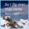
At Harting, another climb to 4000 ft lets us admire the view of Portsmouth Harbour and across to the Isle of Wight. We can see along the coast to Hayling Island and Chichester. The sight that cheers us most is a line of cumulus clouds along the South Downs marking the thermals.
Over the Downs
We set course for Eastbourne, the eastern end of the Downs. Travelling at 70 knots, we pass over the lovely towns and villages, Amberly, Petworth, Steyning, Pulborough and on to Lewes. Towns and villages look much the same from the air. To navigate we look carefully for special features, a railway, river, bypass, or reservoir. Better landmarks are the rivers cutting through the Downs, the Arun, Adur and Ouse.

The seashore on our right is built up from Selsey to Seaford, one continuous strip of urban development, but inland is a patchwork of fields, pastures and grassland on the hilltops. Vivid yellow rape fields are in bloom, and most crops are showing bright green, but there are brown, ploughed fields, darker green woodland and copses and several white scars where the land is quarried for limestone. Some of these have turquoise-green lakes, hidden from ground view by a barrier of dark green trees.

Our eyes cannot enjoy the view for more than a few seconds. We must be aware of other gliders and spot clouds where we may find the next thermal. Sometimes the cloud has no thermal beneath it, and neither has the next one. We are getting low and begin to look for ground features that may trigger a thermal. Supermarket car parks are good, as are built-up areas. Woods and lakes are always cooler than the surroundings and do not produce lift. We have a small two-stroke engine tucked into the fuselage, just in case we run out of height, but we do not need it today.

It takes about an hour to cover the 50 miles east to Polegate, a small town near Eastbourne, where we turn back. The land has warmed in that hour, and a sea breeze has developed. Cool air from the sea kills thermals, so we fly a few miles further inland, careful not to infringe the Gatwick airspace. We are getting peckish, so we take turns flying while the other eats his sandwiches and yes, we have primitive toilet facilities. Dehydration is a danger; together with fatigue, it leads to poor judgement, and we need our full skills for the landing.
Up to Oxford
So, back to Harting and then North towards the airfield at Lasham. But the day is still young, and thermals are strong, so we head further West, to Andover. Then North, towards Oxford, passing close to Highclere Castle (Downton Abbey) on the way to Newbury. In days gone by, we would be looking for the cooling towers at Didcot, which were a helpful landmark but they are long gone. The power station is now a large area of wasteland where thermals are usually available.
Below us winds the Thames with holidaymakers in canal barges and riverboats. We follow it past the nuclear fusion laboratories at Culham and on to the dreaming spires of Oxford. The spires don’t look so romantic from the air as they are foreshortened, but the college district with the narrow streets and grassed quadrangles is easy to spot. Easier though is the large industrial complex of Cowley, another good spot for a thermal. However, we head for the John Radcliffe Hospital which is our turning point.
We take an easterly route back, following the Thames south near Wallingford and Goring. We can see Newbury racecourse and then Greenham Common, the site of the anti-nuclear demonstrations years ago, and now a park.
From Newbury, we head for Basingstoke on the far horizon. On our left is Reading. How much height do we need to get back? We have a computer that calculates that for us, and today, with 4000 feet at Newbury, we can make it without another climb. But, if we have to trust the instrument, it makes us anxious. What if we fly through sinking air on the way? Today, even though the heat is declining, there as plenty of thermals.

And Home
As we cross Basingstoke, we have the height to spare, so turn it into speed and rush back at 120 knots. Still with height to spare, we debate whether to fly off to Andover again, but the thought of a cool beer in the clubhouse wins out, and we prepare to land. We must concentrate, fly a circuit, stow all the loose objects, cameras, drinks and charts; make sure our straps are tight, and it is embarrassing if you land with your wheel up. As we fly past the airfield at 500 feet, we check there are no aircraft in the way and turn in on final approach. Controlling the speed is vital; we lose the last of the height by using airbrakes, touching down at 60 knots.
Now the tricky bit – climbing out of the cockpit having sat comfortably for five hours. Eat your heart out, Tom Cruise and you Top Gun guys. You couldn’t stay airborne that long, burning 20 Kg of fuel per minute, and I bet you don’t have as much fun.

Flight Statistics
Duo Discus XLT 20 M span – G-RAPL. D66
Straight line distance – 373.7 Km
Time – 5 hrs 33 min
Min Height 1300 feet near Petworth
Max height 5600 feet over Newbury


I should never have the courage for this! Your writing, together with the photos, conveys the great height and feeling of immense space, while having to be minutely aware of what you are about and of potential dangers. Thank you for the education!
Mike
Nice descriptive piece. Makes my knees wobble just imagining the heights!
Great post, Mike.
Absolutely brilliant, Mike!!! It was a pleasure to read it. Reminded me of the lines of WB Yeats… The lonely impulse of delight, drove to this tumult in the clouds.
Bravo!