Part One: 1895
You probably know that most of Chandler’s Ford has developed in the last hundred years or so and that prior to the twentieth century, there wasn’t a lot here, apart from a few cottages, the brickfields, farm land and woods. I’ve been looking at the history of one important feature of our town: the main road – Bournemouth Road and Winchester Road – stretching from Asda to the Nuffield Hospital. I wonder what you know of its history?

Let me take you back to 1895. Let’s say you want to travel from Southampton to Winchester and for some reason you don’t take the train, preferring to ride your horse / travel in your carriage or cart by road. The road that goes through our town was the most direct route, a turnpike with an improved surface since the early nineteenth century, unlike other local roads.
Before the railway came in 1847, this road would have been heavily used by the stage coaches that plied between Southampton and London. The horses were changed every six miles and being this distance from both Southampton and Winchester, Chandler’s Ford was the obvious place for the changeover. The coaching stage in our town was where the Fryern Arcade is now, but by 1895 the stables had been redeveloped as a house.

For our journey we have crossed Southampton Common, gone up the lightly developed Bassett Avenue and Winchester Road (passing on your right Bassett Wood where the university is now, then North Stoneham Park). We cross North Stoneham Common and Hut Wood, passing the entrance on the left to Velmore Farm, to the area we now know as the Asda roundabout. At this point a road goes off to the east following the route of present-day Chestnut Avenue, past some gravel pits towards southern Eastleigh, via a place called Middle (perhaps around where the motorway now flies over).
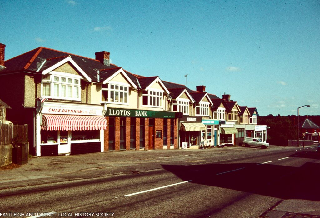
But we don’t take that road – we ride north, passing roads that are now Castle Lane and Leigh Road (where we see Hambledon Cottage on the corner where the car dealership is now). We pass some villas and workers’ cottages, as well as a post office, on the left side of the road. These were likely to have been for workers in the large Bell’s brickfield that lay where Chandler’s Ford Industrial Estate is now. Hildon Villas and York Villas, and Prestonpans Villa (home of the District Superintendent of the London and South Western Railway) are still there. On the right we pass the Hut Hotel originally called the Chandlersford Hotel. If we want to stop for the night we would find accommodation for us and stabling for our horses there.

We reach a junction: the road to Bell’s brickfield goes off on the left and half-left is the road that goes down to the station, where there are some cottages and the stationmaster’s house. Just before the junction there is a school (for pupils up to the age of 14) behind some cottages, also a grocer’s shop and a beerhouse on the main road. If we were to turn left here, we’d see a branch line from the station to the brickworks at the bottom of the hill. But we stay on the main road, crossing the railway bridge, where we can look down towards the station on the busy line between Romsey and Eastleigh: no shops here yet, just the small Mission Church on the right beside the line towards Eastleigh.
We pass the road towards Hursley (an old map shows a Roman road coming in here from the south-west, labelled ‘coming from Nutshilling [Nursling?]). We take the road towards Winchester, past Bampton Copse and cross the Monks Brook over Chandlersford Bridge. To the right behind the trees on high ground is the newly built Fryern Hill Isolation Hospital. Passing one or two properties, we start the ascent through Fryernhill Wood. On the left a lane following the route of present-day Kingsway, confusingly called Kings Road or King’s Lane, goes off through Kings Copse. If we were to call in on to Mr and Mrs Wallis who live at Kings’ Court, the big house at the top of the hill, they might tell us about the ongoing right of way dispute regarding King’s Lane with Mr Purkess.

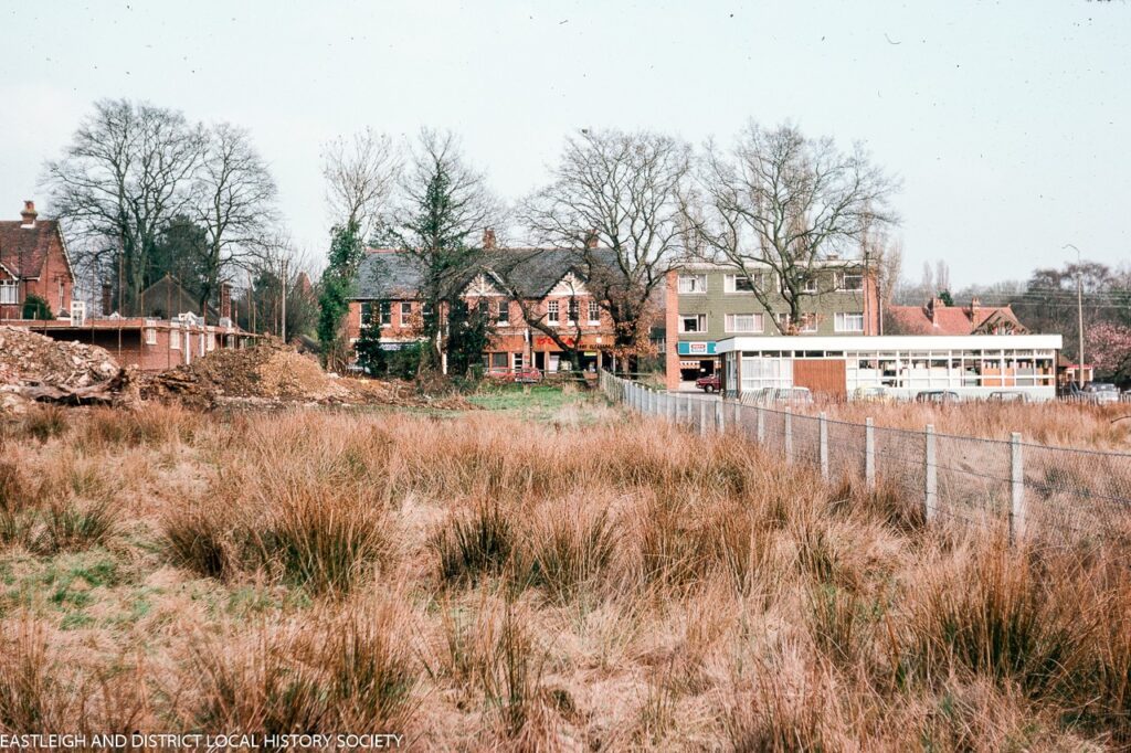
We reach the top of the hill and find some development. As well as King’s Court and its lodge, at Pine Hill Clump (top of Brownhill Road) there is the terrace of Fernhill Cottages (left) and the Halfway Inn on the right, three early eighteenth-century thatched cottages where the library is now and an attractive double-fronted house, ‘Henley’, on the left where Specsavers is now. If the Hursley Hunt is meeting today we may see them at the Halfway Inn, if they aren’t meeting at the Hut Hotel.
If our horses need shoeing the blacksmith’s forge is on the left where the Co-op car park is now and is accessed down a little path. Leaving the development behind, we travel on through Peverells Wood, Birchclose Row and Scantabout Copse. We pass Pitmore Farm on the right (where Thornden and Lakeside Schools, and the Nuffield Hospital are now), before seeing Hocombe Road go to the left, bordering the boundary of Cranbury Park on its right and wooded Hocombe Meadows on its left. The road then continues in a straight line (not the dog-leg we have now to cross the motorway) on to Otterbourne and Winchester.
Sources: Maps of 1985 and 1913 by Frances Frith and various books by Barbara Hillier.
The Main Road Through Chandler’s Ford: Historical Snapshots (Part 2)

Related posts:
 The Main Road Through Chandler’s Ford: Historical Snapshots (Part 2)
 Barbara Hillier: Story of My Great Uncle Wilfred Herbert Hillier and His Memorial Plaque
 An Interactive Local History Talk by Martin Napier
 Christmas Then and Now
 Growing up in Chandler’s Ford: 1950s – 1960s: Passions for Power Boat, Bike, and Lambretta (Part 13)
Fascinating stuff. Keep it coming please.
So the Halfway Inn is so named because it is halfway between Southampton and Winchester.
Middle is the collection of cottages around the junction of Chestnut Avenue and Stoneham Lane. I think it may be short for “Middle Stoneham” – lying between South Stoneham and North Stoneham (the position of North Stoneham church may be misleading, as it was built on the south-eastern edge of North Stoneham Park, rather than in the hamlet itself, which I think was nearer Asda and the aviary estate).
Nutshalling was indeed the old name for what us now called Nursling.
Half Way, as Fryern was called, even in the 1950s, was indeed so called due to being half way between Soton and Winton (old abbreviations).
In the 1950s it was usual to talk about Half Way, not Fryern.
There is a Nutshalling Avenue in Nursling. I think I’ve seen a Nutshalling in a street name or area name elsewhere locally, but can’t remember where
I grew up on Leigh Road, and one of our favourite things to do was sit on top of the old bomb shelter (opposite Truckles) and collect car numbers. Bournemouth Road was so quiet then that we had time to play between one car and the next!
I note the reference to Scantabout. Having recently moved into Scantabout I have tried ti find the source of the name. Can anyone provide any information as to where it came from?
The copse of trees that existed here before the estate was the Scantabout Copse.
Having lived in chandlers ford for 55 years I’ve seen a few changes!! This article is fascinating love local history, thank you